Compartir
A Vegetation Classification and Map: Pecos National Historical Park (en Inglés)
Lisa Arnold
(Autor)
·
Yvonne Chauvin
(Autor)
·
Terri Neville
(Autor)
·
Createspace Independent Publishing Platform
· Tapa Blanda
A Vegetation Classification and Map: Pecos National Historical Park (en Inglés) - Chauvin, Yvonne ; Neville, Terri ; Arnold, Lisa
$ 25.120
$ 50.230
Ahorras: $ 25.110
Elige la lista en la que quieres agregar tu producto o crea una nueva lista
✓ Producto agregado correctamente a la lista de deseos.
Ir a Mis Listas
Origen: Estados Unidos
(Costos de importación incluídos en el precio)
Se enviará desde nuestra bodega entre el
Jueves 11 de Julio y el
Jueves 18 de Julio.
Lo recibirás en cualquier lugar de Chile entre 1 y 3 días hábiles luego del envío.
Reseña del libro "A Vegetation Classification and Map: Pecos National Historical Park (en Inglés)"
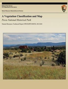
The U.S. Geological Survey (USGS)-National Park Service (NPS) Vegetation Mapping Program and the NPS Southern Plains Network (SOPN) of parks in cooperation with Natural Heritage New Mexico (NHNM, a division of the Museum of Southwestern Biology at the University of New Mexico), and the staff at Pecos National Historical Park (PECO), set out to develop vegetation maps that meet or exceed USGS-NPS standards of 1:24,000-scale and 0.5-ha minimum map unit size (USGS 2010). The maps were based on high-resolution aerial photography along with extensive ground sampling. The project was initiated in 2006 with ensuing field surveys of the vegetation communities through 2011. The vegetation survey data were entered into a database and used to develop a park-wide vegetation classification following the National Vegetation Classification System (FGDC 1997, 2008; Grossman et al. 1998) guidelines.* Then, using the vegetation classification and associated ground control points, vegetation maps were generated at a 1:12,000 scale using a combination of automated image analysis (image segmentation and supervised classifications) and direct image interpretation. Map units were designed to support ecologically based natural resources management with an emphasis on use in fire and wildlife management. The authors provide here the details on how the maps were constructed, an overview of the classification and ecology of the vegetation communities of the monument, the vegetation maps with associated map unit descriptions, plant community descriptions and a diagnostic key, and a vouchered species list. The maps are presented in both paper and digital form as part of a geographic information system (GIS) compatible with that used in the park and national USGSNPS national mapping program. In addition, all field data were compiled into a relational database compatible with USGS-NPS database guidelines, and all data and report elements made ready for web-based applications. Finally, the authors provide an accuracy assessment that reflects both user and producer confidence in the map.
- 0% (0)
- 0% (0)
- 0% (0)
- 0% (0)
- 0% (0)
Todos los libros de nuestro catálogo son Originales.
El libro está escrito en Inglés.
La encuadernación de esta edición es Tapa Blanda.
✓ Producto agregado correctamente al carro, Ir a Pagar.

