Compartir
Fish Lake, Manti (National Geographic Trails Illustrated Map) (en Inglés)
National Geographic Maps (Autor)
·
National Geographic Society Maps
· Nuevo
Fish Lake, Manti (National Geographic Trails Illustrated Map) (en Inglés) - National Geographic Maps
$ 21.160
$ 38.480
Ahorras: $ 17.320
Elige la lista en la que quieres agregar tu producto o crea una nueva lista
✓ Producto agregado correctamente a la lista de deseos.
Ir a Mis Listas
Origen: Reino Unido
(Costos de importación incluídos en el precio)
Se enviará desde nuestra bodega entre el
Jueves 25 de Julio y el
Lunes 05 de Agosto.
Lo recibirás en cualquier lugar de Chile entre 1 y 3 días hábiles luego del envío.
Reseña del libro "Fish Lake, Manti (National Geographic Trails Illustrated Map) (en Inglés)"
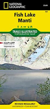
- Waterproof - Tear-Resistant - Topographic MapFish Lake is a high alpine lake nestled in a deep valley at the southern edge of the Wasatch Front. Manti is a small town that serves as a convient staging ground for access to the Manti-La Sal National Forest. This map contains many hundreds of miles of OHV trails with both the Arapeen and Goosberry ATV Trail Systems. The Paiute ATV Trail is shown from Koosharem in the south to Salina in the north.Each trail is clearly marked with its use such as hiking trail or OHV. There are many OHV Staging Areas on the map that are used as launching pads for access to the extensive trail networks. Road and Trail mileages are shown between each intersection which help with trip planning and knowing just how far it is to get back to camp.The Great Western Trail cuts through the middle of the map as it runs north-south on its way from Canada to Mexico. It is marked with a distinct highlight and badge. The Skyline Drive Scenic Backway is also marked for people who want to experience this beautiful landscape from the comfort of their car.Every Trails Illustrated map is printed on "Backcountry Tough" waterproof, tear-resistant paper. A full UTM grid is printed on the map to aid with GPS navigation.Other features found on this map include: Capitol Reef National Park, Castle Valley, Coal Cliffs, Fish Lake, Fishlake National Forest, Manti-La Sal National Forest, Mount Baldy, Mount Marvine.Map Scale = 1:75,000Sheet Size = 37.75" x 25.5"Folded Size = 4.25" x 9.25"
- 0% (0)
- 0% (0)
- 0% (0)
- 0% (0)
- 0% (0)
Todos los libros de nuestro catálogo son Originales.
El libro está escrito en Inglés.
La encuadernación de esta edición es Nuevo.
✓ Producto agregado correctamente al carro, Ir a Pagar.

