Compartir
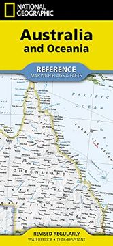
National Geographic Australia and Oceania map (Folded With Flags and Facts) (National Geographic Reference Map) (en Inglés)
National Geographic Maps (Autor)
·
National Geographic Maps
· Nuevo
National Geographic Australia and Oceania map (Folded With Flags and Facts) (National Geographic Reference Map) (en Inglés) - National Geographic Maps
$ 21.160
$ 38.480
Ahorras: $ 17.320
Elige la lista en la que quieres agregar tu producto o crea una nueva lista
✓ Producto agregado correctamente a la lista de deseos.
Ir a Mis Listas
Origen: Reino Unido
(Costos de importación incluídos en el precio)
Se enviará desde nuestra bodega entre el
Jueves 25 de Julio y el
Lunes 05 de Agosto.
Lo recibirás en cualquier lugar de Chile entre 1 y 3 días hábiles luego del envío.
Reseña del libro "National Geographic Australia and Oceania map (Folded With Flags and Facts) (National Geographic Reference Map) (en Inglés)"
- Waterproof - Tear-Resistant - Reference MapExpertly researched and designed, National Geographic's Australia and Oceania Flags & Facts Map is the authoritative map of Australia by which other reference maps are measured. The map side includeds a political map showing countries, cities and other landmarks and a physical map shows the landforms such as mountain ranges and rivers. The Flags & Facts side includes an overview map of Oceania, the section of the Pacific Ocean stretching from New Zealand to the Galapagos Islands.Clearly defined boundaries, major cities, and physical featuresHundreds of place names carefully placed to maintain legibility in heavily populated areasIncludes Australia and Oceania and adjacent regions of AsiaDetailed physical map of Australia with mountain ranges, plains, lakes, and riversFlags and facts with detailed information about cultural and physcial attributesPrinted in the U.S.A. on extremely durable, waterproof, and tear-resistant materialThis Reference Map is printed on durable synthetic paper, making it waterproof, tear-resistant and tough -- capable of withstanding the rigors of any kind of use in the home or classroom.Sheet Size = 18.5" x 25.25"Folded Size = 4.25" x 9.25"
- 0% (0)
- 0% (0)
- 0% (0)
- 0% (0)
- 0% (0)
Todos los libros de nuestro catálogo son Originales.
El libro está escrito en Inglés.
La encuadernación de esta edición es Nuevo.
✓ Producto agregado correctamente al carro, Ir a Pagar.

